| |
|
 |
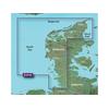
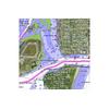
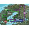
Mapping Coverage: Alborg to the Eider
Read more 
|
|
 |
| |
|
|
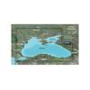
BlueChart® g2 Vision® - VRU002R - Black Sea & Azov Sea -microSD™/SD™See your vessel's precise, on-chart position in relation to navaids, coastal features and restricted areas with premium features found in this detailed marine mapping
Read more
|
|
|
| |
|
|
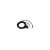
GFStm 10 FUEL SENSORAdd fuel tracking capabilities to your Garmin chartplotter andoptimize your boats fuel economy The GFS 10 tracks fuel flow use andsends the data to your chartplotter via the Garmin CANet or NMEA 2000
Read more
|
|
|
| |
|
|
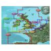
Mapping Coverage: Ireland, West Coast
Read more
|
|
|
| |

|
|
Mapping Coverage: Scotland West Coast
Read more
|
|
|
| |

|
|
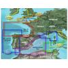
Mapping Coverage: Bay of Biscay
Read more
|
|
|
| |

|
|
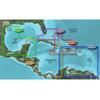
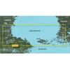
Covers: The Coasts of Maine and New Brunswick from Machias Bay, ME to Saint John, NB
Read more
|
|
|
| |
|
|
Covers: Crystal River through Key Largo
Read more
|
|
|
| |

|
|
Mapping Coverage: Mediterranean Southeast
Read more
|
|
|
| |
|
|
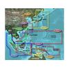
Garmin Hae009r, Bay Of Bengal Kupang&manado, Bluechart, Microsd/sd G2, . See More of Your Surroundings.
Read more
|
|
|
| |
|
|
Southeast Florida
Read more
|
|
|
| |
|
|
Mapping Coverage: Alborg to Amsterdam
Read more
|
|
|
| |

|
|
Mapping Coverage: Falster, Lolland, Langeland and Fehmarn
Read more
|
|
|
| |
|
|
Mapping Coverage: Turku, Helsinki and Kotka in Finland
Read more
|
|
|
| |
|
|
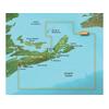
Covers: Eastern Nova Scotia from Halifax to Sydney, around Cape St. Lawrence, and Down to Antigonish
Read more
|
|
|
| |
|
|
Mapping Coverage: Hudiksvall, Gavle and Soderhamn
Read more
|
|
|
| |

|
|
Mapping Coverage: France To Crotone, Italy
Read more
|
|
|
| |
|
|
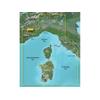
Mapping Coverage: Lago Maggiore and Lago Di Garda in Northern Italy
Read more
|
|
|
| |
|
|
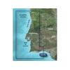
Mapping Coverage: Portugal
Read more
|
|
|
| |
|
|
Mapping Coverage: Felixstowe To The Isles Of Scilly
Read more
|
|
|
| |

|
|
Mapping Coverage: Germany To Calais, France
Read more
|
|
|
| |
|
|
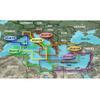
Mapping Coverage: Italy Adriatic Sea
Read more
|
|
|
| |
|
|
Garmin Thru-Hull Mount Smart Transducer (010-11105-00) Brand New Includes One Year Warranty, The Garmin 010-11105-00 thru-hull mount smart transducer with depth and temperature (20° Tilt) features the tilted element and broadband technology and this...
Read more
|
|
|
| |

|
|
Mapping Coverage: Sognefjorden
Read more
|
|
|


 Switch to grid view