| |
|
 |
Read more 
|
|
 |
| |

|
|
For: GPSMAP 5212, 5208, 5012, 5008 and 4212
Read more
|
|
|
| |
|
|
Pre Programmed Card Includes: Mapping Coverage of Boston to Atlantic
Read more
|
|
|
| |

|
|
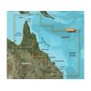
Maps of Jacksonville to Bahamas
Read more
|
|
|
| |

|
|
Card Includes: Detailed Mapping Software of Penobscot Bay Through Gloucester
Read more
|
|
|
| |

|
|
Card Includes: Detailed Mapping Software of Point Arena to Puerto Vallarta, including Mendocino, San Francisco Bay, Channel Islands, San Diego, and the Baja Peninsula
Read more
|
|
|
| |
|
|
Card Includes: Mapping Coverage of Southern Sweden From Sodertalje to Trelleborg
Read more
|
|
|
| |
|
|
Pre Programmed Card Includes: Mapping Coverage of Southern Bahamas
Read more
|
|
|
| |
|
|
Card Includes: Mapping Software of East Coast Austrailia
Read more
|
|
|
| |

|
|
Card Includes: Detailed Mapping Software of Gulf of Mexico from Matagorda Bay to Belize City, including Corpus Christi, TX, Veracruz, Mex., the Bay of Campeche, Cancun, Mex., and Cozumel, Mex
Read more
|
|
|
| |

|
|
Maps of Southwest Caribbean
Read more
|
|
|
| |

|
|
Pre Programmed Card Includes: Mapping Coverage of North Maine - For: GPSMAP 4XXX, 5X5, 5x0 and 4X0 Series
Read more
|
|
|
| |

|
|
Card Includes: Detailed Mapping Software of Wrangell to Glacier Bay, Sitka and Juneau
Read more
|
|
|
| |

|
|
Norfolk to Charleston BlueChart g2 Vision
Read more
|
|
|
| |

|
|
Compatible with: Garmin Quest, Garmin StreetPilot
Read more
|
|
|
| |
|
|
VEU015R Covers:Including all of the Greek coast and Aegean Sea; Turkey from Istanbul and Sea of Marmara to Antalya; and Brindisi, Italy.
Read more
|
|
|
| |
|
|
Compatible with: Garmin eMap, Garmin NavTalk, Garmin Quest, Garmin StreetPilot
Read more
|
|
|
| |
|
|
VEU455S Covers: Spanish coast: from Denia to Cabo De São Vicente, including Cabo de Palos, Golfo de Mazarron, Golfo de Almeria, Bahia de Malaga, Ensenada de Marbella, Bahia de Algeciras, Estrecho de Gibraltar, Cadiz, Rio Guadalquivir, Huelva, ...
Read more
|
|
|
| |

|
|
VUS517L Covers:Detailed coverage of Alaska, from Prince of Wales Island to Point Lay on the North Slope, including Glacier Bay, the Kenai Peninsula, and the Aleutian Chain in full. Bathymetric coverage of the Gulf of Alaska, Bristol Bay and United...
Read more
|
|
|
| |

|
|
Maps of Southeast Caribbean
Read more
|
|
|
| |

|
|
Card Includes: Detailed Mapping Software of Gulf of Mexico from Brownsville, TX to Plantation Key, FL including Corpus Christi, TX, Matagorda Bay, Galveston Bay, Port Arthur, TX, Atchafalaya Bay, the Mississippi Delta, Chandeleur Islands, Tampa Bay and th
Read more
|
|
|
| |

|
|
Pre Programmed Card Includes: Mapping Coverage of Mid Atlantic
Read more
|
|
|
| |
|
|
The GMS 10 Network Port Expander is the in.nerve center in. of the Garmin Marine Network. This 100-Mbit switch is designed to support the connection of multiple sensors and the GPSMAP 3006C and GPSMAP 3010C chartplotters/multifunction displays (MFDs) to
Read more
|
|
|
| |
|
|
vpc413s covers:detailed coverage of the northeastern coast of australia from mornington island to hervey bay. also includes detailed coverage of cape york cairns townsville mackay and the great barrier reef.bluechart g2 visionwhat is bluechart
Read more
|
|
|


 Switch to grid view