| |

|
 |
Includes: Maps of Charleston to Jacksonville - For GPS MAP 4XXX - 5X5 - 5x0 - 4X0 Series
Read more 
|
|
 |
| |

|
|
Card Includes: Detailed Mapping Software of Gulf of Mexico from Matagorda Bay to Belize City, including Corpus Christi, TX, Veracruz, Mex., the Bay of Campeche, Cancun, Mex., and Cozumel, Mex
Read more
|
|
|
| |

|
|
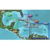
Maps of Southwest Caribbean
Read more
|
|
|
| |
|
|
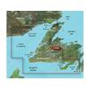
Pre Programmed Card Includes: Mapping Coverage of Les Mechins to St. Georges Bay - For: GPSMAP 4XXX, 5X5, 5x0 and 4X0 Series
Read more
|
|
|
| |
|
|
Pre Programmed Card Includes: Mapping Coverage of Newfoundland West - For: GPSMAP 4XXX, 5X5, 5x0 and 4X0 Series
Read more
|
|
|
| |

|
|
Card Includes: Detailed Mapping Software of Wrangell to Glacier Bay, Sitka and Juneau
Read more
|
|
|
| |
|
|
Pre Programmed Card Includes: Mapping Coverage of Southern Bahamas
Read more
|
|
|
| |

|
|
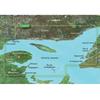
Norfolk to Charleston BlueChart g2 Vision
Read more
|
|
|
| |
|
|
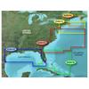
Pre Programmed Card Includes: Mapping Coverage of Boston to Atlantic
Read more
|
|
|
| |

|
|
Maps of Jacksonville to Bahamas
Read more
|
|
|
| |
|
|
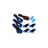
The SeaTalkng Backbone kit contains everything you need to construct and wire a basic SeaTalkng navigation network backbone on board your vessel. The kit contains the following components:A06031 SeaTalkng Terminators (Qty. 2)A06037 Backbone Cable, 20mA060
Read more
|
|
|
| |

|
|
Card Includes: Detailed Mapping Software of Point Arena to Puerto Vallarta, including Mendocino, San Francisco Bay, Channel Islands, San Diego, and the Baja Peninsula
Read more
|
|
|
| |

|
|
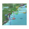
Maps of Southeast Caribbean
Read more
|
|
|
| |

|
|
VUS517L Covers:Detailed coverage of Alaska, from Prince of Wales Island to Point Lay on the North Slope, including Glacier Bay, the Kenai Peninsula, and the Aleutian Chain in full. Bathymetric coverage of the Gulf of Alaska, Bristol Bay and United...
Read more
|
|
|
| |

|
|
Card Includes: Detailed Mapping Software of Atchafalaya Bay to Brownsville, including Port Arthur, Galveston Bay, Matagorda Bay, and Padre Island
Read more
|
|
|
| |

|
|
Card Includes: Detailed Mapping Software of Gulf of Mexico from Brownsville, TX to Plantation Key, FL including Corpus Christi, TX, Matagorda Bay, Galveston Bay, Port Arthur, TX, Atchafalaya Bay, the Mississippi Delta, Chandeleur Islands, Tampa Bay and th
Read more
|
|
|
| |

|
|
Compatible with: Garmin eMap, Garmin Quest, Garmin StreetPilot
Read more
|
|
|
| |

|
|
Furuno Navnet 3D Hub 101 HUB101 The HUB101 is the center of your NavNet 3D system, connecting all of your displays and components together and allowing for the distribution of information across the network. NavNet 3D is built on an Ethernet network, allo
Read more
|
|
|
| |

|
|
Compatible with: Garmin Quest, Garmin StreetPilot
Read more
|
|
|
| |
|
|
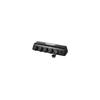
The GMS 10 Network Port Expander is the in.nerve center in. of the Garmin Marine Network. This 100-Mbit switch is designed to support the connection of multiple sensors and the GPSMAP 3006C and GPSMAP 3010C chartplotters/multifunction displays (MFDs) to
Read more
|
|
|
| |

|
|
Whether you're riding on the streets or the trail, you won't have to quit when the sun does. When your speed varies, Varia UT800 adjusts too. When paired with compatible Edge cycling computers, the UT800 adjusts brightness to give the lumens you need...
Read more
|
|
|
| |

|
|
Pre Programmed Card Includes: Mapping Coverage of Mid Atlantic
Read more
|
|
|
| |
|
|
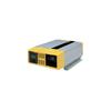
Providing 1000 & 1800 watts of sine wave AC power from a DC source Offering superior quality true sine wave output, the Prosine 1000 and 1800 stand-alone power inverters are ideally suited for electrical systems that already have a quality multistage batt
Read more
|
|
|
| |
|
|
Compatible with: Garmin eMap, Garmin NavTalk, Garmin Quest, Garmin StreetPilot
Read more
|
|
|


 Switch to grid view