| |

|
 |
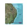
Maps of Southwest Caribbean
Read more 
|
|
 |
| |

|
|
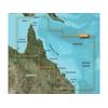
Card Includes: Detailed Mapping Software of Wrangell to Glacier Bay, Sitka and Juneau
Read more
|
|
|
| |
|
|
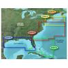
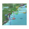
Pre Programmed Card Includes: Mapping Coverage of Boston to Atlantic
Read more
|
|
|
| |

|
|
Includes: Maps of Charleston to Jacksonville - For GPS MAP 4XXX - 5X5 - 5x0 - 4X0 Series
Read more
|
|
|
| |

|
|
Card Includes: Detailed Mapping Software of Gulf of Mexico from Matagorda Bay to Belize City, including Corpus Christi, TX, Veracruz, Mex., the Bay of Campeche, Cancun, Mex., and Cozumel, Mex
Read more
|
|
|
| |
|
|
Pre Programmed Card Includes: Mapping Coverage of Les Mechins to St. Georges Bay - For: GPSMAP 4XXX, 5X5, 5x0 and 4X0 Series
Read more
|
|
|
| |
|
|
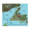
Pre Programmed Card Includes: Mapping Coverage of Newfoundland West - For: GPSMAP 4XXX, 5X5, 5x0 and 4X0 Series
Read more
|
|
|
| |
|
|
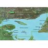
Pre Programmed Card Includes: Mapping Coverage of Southern Bahamas
Read more
|
|
|
| |

|
|
Norfolk to Charleston BlueChart g2 Vision
Read more
|
|
|
| |

|
|
Maps of Jacksonville to Bahamas
Read more
|
|
|
| |

|
|
Card Includes: Detailed Mapping Software of Point Arena to Puerto Vallarta, including Mendocino, San Francisco Bay, Channel Islands, San Diego, and the Baja Peninsula
Read more
|
|
|
| |
|
|
Card Includes: Mapping Software of East Coast Austrailia
Read more
|
|
|
| |
|
|
vpc413s covers:detailed coverage of the northeastern coast of australia from mornington island to hervey bay. also includes detailed coverage of cape york cairns townsville mackay and the great barrier reef.bluechart g2 visionwhat is bluechart
Read more
|
|
|
| |

|
|
Compatible with: Garmin eMap, Garmin Quest, Garmin StreetPilot
Read more
|
|
|
| |

|
|
Compatible with: Garmin Quest, Garmin StreetPilot
Read more
|
|
|
| |

|
|
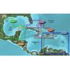
Card Includes: Detailed Mapping Software of Gulf of Mexico from Brownsville, TX to Plantation Key, FL including Corpus Christi, TX, Matagorda Bay, Galveston Bay, Port Arthur, TX, Atchafalaya Bay, the Mississippi Delta, Chandeleur Islands, Tampa Bay and th
Read more
|
|
|
| |
|
|
Compatible with: Garmin eMap, Garmin NavTalk, Garmin Quest, Garmin StreetPilot
Read more
|
|
|
| |

|
|
VUS517L Covers:Detailed coverage of Alaska, from Prince of Wales Island to Point Lay on the North Slope, including Glacier Bay, the Kenai Peninsula, and the Aleutian Chain in full. Bathymetric coverage of the Gulf of Alaska, Bristol Bay and United...
Read more
|
|
|
| |
|
|
Take the easy route to ELD compliance. The easy-to-use Garmin eLog compliant ELD (FMCSA-registered electronic logging device) is a simple one-time purchase with no subscription fees. The device automatically tracks and records Hours of Service (HOS)....
Read more
|
|
|
| |

|
|
Whether you're riding on the streets or the trail, you won't have to quit when the sun does. When your speed varies, Varia UT800 adjusts too. When paired with compatible Edge cycling computers, the UT800 adjusts brightness to give the lumens you need...
Read more
|
|
|
| |
|
|
Our Canada LakeVü HD and Canada LakeVü HD Ultra products feature over 13, 500 lakes with detailed depth information. Includes provinces of Alberta, British Columbia, Nova Scotia, Ontario, Quebec, Saskatchewan, and Yukon provinces. It also includes...
Read more
|
|
|
| |

|
|
Maps of Southeast Caribbean
Read more
|
|
|
| |

|
|
Pre Programmed Card Includes: Mapping Coverage of Mid Atlantic
Read more
|
|
|
| |

|
|
Card Includes: Detailed Mapping Software of Atchafalaya Bay to Brownsville, including Port Arthur, Galveston Bay, Matagorda Bay, and Padre Island
Read more
|
|
|


 Switch to grid view