| |
|
 |
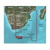
Af. to the mouth of the Zambezi River. Detailed coverage includes Port Elizabeth and Durban, S. Af., Maputo, Moz., as well as the Prince Edward Islands. 010-C0752-00 Garmin Vaf452S Knysna Sa To Beira Mz G2 Vision Sd VAF452S Covers: Coverage of the southea
Read more 
|
|
 |
| |
|
|
VAW005R Covers:Coverage of the Arabian Peninsula beginning at the Mediterranean Sea from Beirut to Alexandria. Coverage includes the Suez Canal, Gulf of Aqaba, and the Red Sea and Gulf of Aden in their entirety. Includes the Strait of Hormuz, Gulf of Oman
Read more
|
|
|
| |
|
|
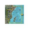
VAF001R Covers:General coverage of the east coast of Africa from the Gulf of Tadjoura to the Bay of Maputo, including Mogadishu, Som., Mombasa, Ken., and Dar es Salaam, Tan. Also inclu
Read more
|
|
|
| |
|
|
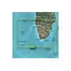
Includes detailed coverage of Durban S. Af. and Maputo, Moz. Also includes detailed coverage of the Tristan da Cunha Group, the island of St. Helena, and the Prince Edward Islands. 010-C0748-00 Garmin Vaf002R South Africa G2 Vision Sd VAF002R Covers: Deta
Read more
|
|
|
| |
|
|
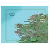
VEU484S Covers:Detailed coverage of Northwestern Ireland from Londonderry to Galway Bay. Also includes detailed coverage of Sligo, Ballina, Galway, and Donegal Bay.3-D View = Yes | Aerial Photos = Yes | Port Plans = Yes | Card Format = SD
Read more
|
|
|
| |
|
|
On SD Memory Card Plug a BlueChart g2 Vision SD data card into your chartplotter, and youll get a whole new perspective on nautical navigation. BlueChart g2 Vision offers the same rich detailed charting of BlueChart g2 to help you get the most out of your
Read more
|
|
|
| |

|
|
BlueChart g2 Vision offers the same rich detailed charting of BlueChart g2 to help you get the most out of your unit. In addition, g2 Vision features a growing database of high-resolution satellite imagery, above and below the water 3D perspective, auto g
Read more
|
|
|
| |

|
|
This chart covers: Entire Lake Michigan including Green Bay and Lake Winnebago. Platinum+ Multi-Dimensional Charts Navionics Gold plus 3D with TurboView, high resolution photo/chart overlay, port photos, geo-referenced coast pilots, and fishing detail. Na
Read more
|
|
|
| |

|
|
B164 Tilted Element0Features:Depth/Temp50/200 kHz1 kW RMSHigh-performanceBronzeStep up to a 1kW Without a Fairing! Airmar has taken our innovative Tilt
Read more
|
|
|
| |

|
|
VEU465S Covers:Detailed coverage from Bermeo, Spain to St. Nazaire, France including La Rochelle, Cap Ferret, and La Gironde.3-D View = Yes | Aerial Photos = Yes | Port Plans = Yes | Card Format = SD
Read more
|
|
|
| |

|
|
VEU055R Covers:Detailed coverage of inland Finnish lakes including Inarijarvi, Miekojarvi, Simojarvi, and Kiantajarvi. Also includes detailed coverage of Oulujarvi, Pielinen, Saimaa, Paijanne, Nasijarvi, Lohjanjrvi, and others.
Read more
|
|
|
| |

|
|
Plug a BlueChart g2 Vision SD data card into your chartplotter, and youll get a whole new perspective on nautical navigation. BlueChart g2 Vision offers the same rich detailed charting of BlueChart g2 to help you get the most out of your unit. In addition
Read more
|
|
|
| |

|
|
VAW450S Covers: Detailed coverage the of Kuwait, Saudi Arabia, Qatar, United Arab Emirates, along the southern coast of the Gulf, including Al-Fuhaihil, Ad-Dammam, Bahrain, Ad-Dauha, and Abu Dhabi. Coverage of Iran along the northern coast of the Gulf inc
Read more
|
|
|
| |

|
|
Garmin Veu058r, Greenland West, Bluechart G2 Vision, Microsd/sd . Plug a Vision card into any Garmin 5000/4000, 500/400 Series chartplotter to add premium mapping features and enhanced graphical capabilities. All the new Garmin plotters feature a worldwid
Read more
|
|
|
| |

|
|
HUMMINBIRD ACCESSORIES Transom Mount Transducer (Includes 20 ft. Cable & Hardware). XNT 9 DI T Single/Down Imaging, 200kHz+455/800kHz, Temp, In-Hull Mounting Epoxy.
Read more
|
|
|
| |

|
|
Garmin VEU454S - Barcelona and Valencia - SD Card VEU454S Covers: From Port de Bouc, France to Cabo de Palos, Spain, including Islas Baleares.
Read more
|
|
|
| |

|
|
VEU464S Covers:Detailed coverage from Guilvinec to Les Sables DOlonne including St. Nazaire, the Loire to Nantes, Belle Ile, Ile de Groix, and Ile dYeu.3-D View = Yes | Aerial Photos = Yes | Port Plans = Yes | Card Format = NONE
Read more
|
|
|
| |

|
|
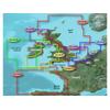
VEU482S Covers:Detailed coverage of Southern Ireland from Wexford to Ventry. Also includes detailed coverage of Dungarvan, Cork, and Cahersiveen.3-D View = Yes | Aerial Photos = Yes | Port Plans = Yes | Card Format = SD
Read more
|
|
|
| |

|
|
VEU461S Covers: Great Yarmouth to Folkestone - including Thames Estuary and River to Teddington Lock.
Read more
|
|
|
| |

|
|
010-C0834-00 Garmin Veu490S Greece West Coast and Athens Bluechart G2 VEU490S Covers: Detailed coverage of the southwestern coast of Greece from Vlore, Albania to Athens, Greece. Also includes detailed coverage of Preveza, Patra, Peloponnisos, and the Cyc
Read more
|
|
|
| |

|
|
VEU488S Covers:Detailed coverage of inland Finnish lakes including Keitele, Puula, and Paijanne. Also includes detailed coverage of Ahtarinjarvi, Nasijarvi, Pyhajarvi, and Lohjanjarvi.3-D View = Yes | Aerial Photos = Yes | Port Plans = Yes | Card Format =
Read more
|
|
|
| |

|
|
VEU486S Covers: From Cabo Ajo, Spain to Praia da Aguda, Portugal. Also including Suances, Ribadesella, Tazones, Gijon, Candas, Aviles, San Juan de la Arena, Cudillero, Navia, Figueras, Burela, Los Farallones, Vivero, Ensenada de Cario, Cedeira, El Ferrol
Read more
|
|
|
| |

|
|
010-C0844-00 Garmin Veu500S Blythe To Lowestoft Bluechart G2 Vision VEU500S Covers: Detailed coverage of the English coast from Blyth to Lowestoft, including Newcastle, Middlesbrough, Kingston Upon Hull, The Wash, and Boston. Also includes coverage of the
Read more
|
|
|
| |

|
|
Plug a BlueChart g2 Vision SD data card into your chartplotter, and youll get a whole new perspective on nautical navigation. BlueChart g2 Vision offers the same rich detailed charting of BlueChart g2 to help you get the most out of your unit. In addition
Read more
|
|
|


 Switch to grid view