| |

|
 |
This chart covers: GULF OF ST. LAWRENCE, NEWFOUNDLAND Including Cape Breton Island, Iles De La Madeleine, Prince Edward Island and Strait of Belle Isle. Platinum+ Multi-Dimensional Charts Navionics Gold plus 3D with TurboView, high resolution photo/chart
Read more 
|
|
 |
| |
|
|
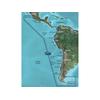
GARMIN VSA002R SOUTH AMERICA WEST G2 VISION
Read more
|
|
|
| |

|
|
VEU055R Covers:Detailed coverage of inland Finnish lakes including Inarijarvi, Miekojarvi, Simojarvi, and Kiantajarvi. Also includes detailed coverage of Oulujarvi, Pielinen, Saimaa, Paijanne, Nasijarvi, Lohjanjrvi, and others.
Read more
|
|
|
| |

|
|
Pump has a dry prime suction lift of about 6 and a lift to 20 when primed. Pump ports have external 1" hose barb and internal 1/2" pipe threads.
Read more
|
|
|
| |

|
|
RS150 GPS/Glonass Receiver, 10Hz, MFG# E70310, The rugged RS150 is designed for surface or pole mounted with the optional pole mounting kit. The RS150 is SeaTalk-ng compatible and NMEA 2000. Includes a 3m SeaTalk-ng cable and surface mounting hardware....
Read more
|
|
|
| |

|
|
It is SeaTalk compatible and can be used on yachts up to 18, 700 lbs (8, 500kg) weight. The package contains wheel only - not a complete autopilot. E12093 Features: ST4000MK2 Wheel Drive, Part Number: E12093, For Yachts up to 18, 700 lbs (8, 500kg) Weight
Read more
|
|
|
| |

|
|
VEU046R Covers: Detailed coverage of the Southeast coast of Sweden from regrund to Copenhagen, Den. Includes detailed coverage of Stockholm and Nykoping, and lakes Sommen, Nommen, as well as coverage of the lower Dallven from Gysinge to Sderfors. Also inc
Read more
|
|
|
| |

|
|
VEU486S Covers: From Cabo Ajo, Spain to Praia da Aguda, Portugal. Also including Suances, Ribadesella, Tazones, Gijon, Candas, Aviles, San Juan de la Arena, Cudillero, Navia, Figueras, Burela, Los Farallones, Vivero, Ensenada de Cario, Cedeira, El Ferrol
Read more
|
|
|
| |

|
|
Garmin Veu058r, Greenland West, Bluechart G2 Vision, Microsd/sd . Plug a Vision card into any Garmin 5000/4000, 500/400 Series chartplotter to add premium mapping features and enhanced graphical capabilities. All the new Garmin plotters feature a worldwid
Read more
|
|
|
| |

|
|
On SD Memory Card BlueChart g2 Vision offers the same rich detailed charting of BlueChart g2 to help you get the most out of your unit. In addition, g2 Vision features a growing database of high-resolution satellite imagery, above and below the water 3D p
Read more
|
|
|
| |

|
|
On SD Memory Card Plug a BlueChart g2 Vision SD data card into your chartplotter, and youll get a whole new perspective on nautical navigation. BlueChart g2 Vision offers the same rich detailed charting of BlueChart g2 to help you get the most out of your
Read more
|
|
|
| |

|
|
BlueChart g2 Vision offers the same rich detailed charting of BlueChart g2 to help you get the most out of your unit. In addition, g2 Vision features a growing database of high-resolution satellite imagery, above and below the water 3D perspective, auto g
Read more
|
|
|
| |

|
|
VEU488S Covers:Detailed coverage of inland Finnish lakes including Keitele, Puula, and Paijanne. Also includes detailed coverage of Ahtarinjarvi, Nasijarvi, Pyhajarvi, and Lohjanjarvi.3-D View = Yes | Aerial Photos = Yes | Port Plans = Yes | Card Format =
Read more
|
|
|
| |

|
|
Garmin VEU054R - Vestfjd-Svalbard-Varanger - SD Card 010-C0790-00 Garmin Veu054R Vestfjd Svalbard Varanger Bluechart G2 VEU054R Covers: Detailed coverage of the northern Norway coast from Vestfjorden to Vadso including Troms and Narvik. Also includes cove
Read more
|
|
|
| |

|
|
Plug a BlueChart g2 Vision SD data card into your chartplotter, and youll get a whole new perspective on nautical navigation. BlueChart g2 Vision offers the same rich detailed charting of BlueChart g2 to help you get the most out of your unit. In addition
Read more
|
|
|
| |

|
|
VEU461S Covers: Great Yarmouth to Folkestone - including Thames Estuary and River to Teddington Lock.
Read more
|
|
|
| |

|
|
VEU464S Covers:Detailed coverage from Guilvinec to Les Sables DOlonne including St. Nazaire, the Loire to Nantes, Belle Ile, Ile de Groix, and Ile dYeu.3-D View = Yes | Aerial Photos = Yes | Port Plans = Yes | Card Format = NONE
Read more
|
|
|
| |

|
|
On SD Memory Card Plug a BlueChart g2 Vision SD data card into your chartplotter, and youll get a whole new perspective on nautical navigation. BlueChart g2 Vision offers the same rich detailed charting of BlueChart g2 to help you get the most out of your
Read more
|
|
|
| |

|
|
010-C0780-00 Garmin Veu043R Iceland and Faeroe Islands Bluechart G2 VEU043R Covers: Includes detailed coverage of all of Iceland including the cities of Reykjavik and Akureyri. Also includes detailed coverage of the Faeroe Islands including Stromo, Ostero
Read more
|
|
|
| |

|
|
Plug a BlueChart g2 Vision SD data card into your chartplotter, and youll get a whole new perspective on nautical navigation. BlueChart g2 Vision offers the same rich detailed charting of BlueChart g2 to help you get the most out of your unit. In addition
Read more
|
|
|
| |

|
|
With Garmin''s NMEA 2000 Trim Tab Analog Adapter aboard your vessel, you can give new life to your old gauges by making the transition from analog to digital. This simple-to-install adapter takes the data generated by traditional analog gauges and convert
Read more
|
|
|
| |

|
|
BlueChart g2 Vision offers the same rich detailed charting of BlueChart g2 to help you get the most out of your unit. In addition, g2 Vision features a growing database of high-resolution satellite imagery, above and below the water 3D perspective, auto g
Read more
|
|
|
| |

|
|
010-C0834-00 Garmin Veu490S Greece West Coast and Athens Bluechart G2 VEU490S Covers: Detailed coverage of the southwestern coast of Greece from Vlore, Albania to Athens, Greece. Also includes detailed coverage of Preveza, Patra, Peloponnisos, and the Cyc
Read more
|
|
|
| |
|
|
RITCHIE COMPASS RITCHIE HB-845 HELMSMAN COMPASS STEEL BOAT
Read more
|
|
|


 Switch to grid view